October 8, 2026
What GSD do you need to tell weed from crop at leaf scale?
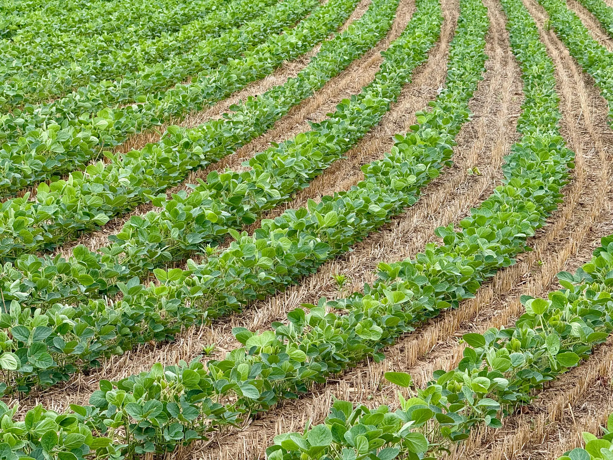
Every grower who's looked at a weed layer from a mapping flight has asked some version of the same question: how fine does this imagery need to be before the map tells you anything you can spray against? There's no single number you can tape to the dash. It depends on growth stage, row spacing, and what you're trying to separate the weed from. But there's a line below which the question stops mattering, and above which no amount of processing fixes it.
The leaf-scale problem
A weed and a crop plant at the four-leaf stage can occupy the same few square centimetres of ground. If your imagery can't resolve individual leaves, it can't tell you which leaves belong to which plant, it can only tell you something green is growing there. That's fine for a canopy vigor map. It's a problem for a patch map you're going to run a sprayer against, because "something green" includes the crop.
Leaf scale is the working definition most people in this business land on: can you see leaf shape, leaf edge, and the gap between individual plants, not just a blob of canopy. For row crops at early-to-mid vegetative stages, that generally means a ground sample distance of 2 cm or finer. Above roughly 3-5 cm GSD, a weed rosette and a crop seedling blur into the same handful of pixels and the software, or a person squinting at the ortho, is guessing, not measuring.
That resolution comes from a UAV flown low enough to resolve individual leaves, with a sensor-and-altitude combination that satellites and most fixed-wing aircraft can't match at useful area-per-hour rates. The flight plan has to account for crop height, wind, and battery legs on anything over a quarter section. That's the trade-off: finer GSD buys you leaf-scale separation, and it costs you flight time per acre.
Why "good enough" GSD still misses patches
Here's the part that trips people up. A field can come back from a 3 cm flight looking clean, with a vigor map that shows nothing unusual, while a weed patch sits right under a few thick canopy rows where the crop is already closing gaps. The imagery was adequate for the crop but not for the problem you were actually trying to solve, which is finding the weed hiding at ground level under a crop canopy that reads as uniform from above. This is less about megapixels and more about what the resolution lets you resolve once the pixels get processed: plant-by-plant separation versus a field-average greenness score.
It also depends on what weed you're chasing. A tall, structurally distinct weed sticking well above a short crop canopy can sometimes be flagged at coarser GSD because its shape and shadow give it away even when individual leaves aren't crisp. A low-growing broadleaf tucked between crop rows at the same height needs the finer end of that 2 cm range, full stop. If your spray window is tight and you're deciding boom section control zones off this map, spec the finer number for this field rather than reusing whatever worked last season somewhere else.
What this means for the flight you're planning this week
If the deliverable is a treat map you're going to load into section shutoff software, spec the imagery so it holds up at leaf scale on the field's toughest patch, the thick canopy rows where a weed hides, since that's the patch the sprayer needs the map to catch. That usually means specifying 2 cm GSD or finer on the UAV pass and treating anything coarser as a scouting reference rather than a spray instruction. Blanket-rate thinking creeps back in fast when the map is ambiguous, because nobody wants to shut off a boom section on a guess.
That's the gap a per-pass weed map is built to close: imagery flown fine enough to separate weed from crop at leaf scale, turned into a spray-ready patch map matched to the pass that flew it, so the sprayer treats the square metres that need chemical instead of the whole field. If this week's flight plan needs that resolution, take a look at how Weed Mapping handles per-pass patch mapping before you lock in the GSD.