November 9, 2026
What is leaf-scale detection, and why can't field-scale imagery do it?
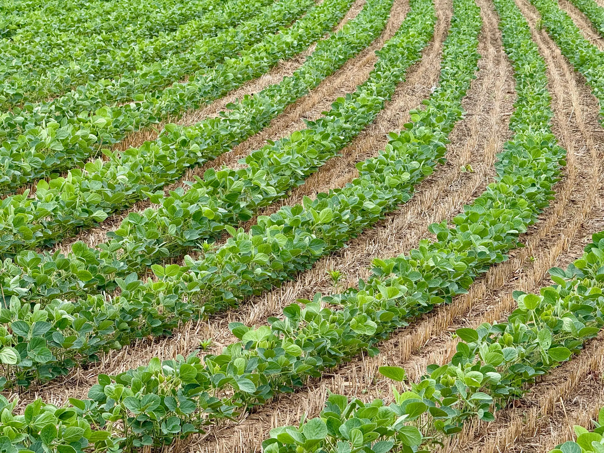
If you've ever pulled up a field-scale vegetation index and tried to turn it into a treat map, you've run into the same wall every spray contractor does: the imagery tells you a zone is "stressed," not what's growing in it. A patch of pigweed and a patch of drought-stunted crop can throw the same signal. That gap is a resolution problem: the imagery's pixel size determines whether a single weed shows up as itself or gets averaged into the background along with everything around it.
Leaf scale versus field scale
Leaf-scale detection means the imagery is sharp enough to tell one plant from another, weed from crop, by shape and texture at the leaf. To do that you need ground sample distance (GSD) around 2 cm or finer. At that GSD, a single weed leaf might cover several pixels instead of being blended into one.
Field-scale imagery, the kind that comes off a lot of satellite passes and some fixed-wing ag flights, runs anywhere from half a meter to several meters per pixel. At that scale, a single pixel is averaging a weed, bare dirt, residue, and healthy crop together into one value. You get a useful index for spotting trouble zones. You don't get a boundary you can hand to a sprayer and expect boom section control to respect.
This is the gap that turns a "weed problem" map into a guess. Ops leads scheduling this week's runs already know what the zoomed-out view is good for: pointing at a zone worth checking. Turning individual nozzles off section by section still takes a tighter answer than that.
Why the pixel size is the whole argument
RGB imagery from a UAV or crewed aircraft at 2 cm GSD or finer captures color and leaf shape in enough detail that weed and crop can be told apart plant by plant, not zone by zone. That's the difference between a map that says "treat this general area" and one that says "treat these square meters, skip the rest."
Run the math on what that means for a pass. Blanket rate across a quarter section costs the same whether 5% or 40% of that ground has weed pressure in it. A patch map built at leaf scale lets the rig spot-spray the infested ground and leave the clean ground alone, which is the entire point of having section shutoff on the boom in the first place. Field-scale data can't drive that decision because it was never built to resolve a single plant. It was built to flag a zone over a few hundred acres, which is a different job with a different use.
None of this means field-scale imagery is useless. It's the right tool for scouting a whole operation's acreage fast, for flagging which fields need a closer look this week. But once a field is flagged and a pass is scheduled, the question changes from "where might there be weeds" to "exactly where are they," and that second question needs leaf-scale resolution to answer.
What this means for scheduling a pass
If the goal is a spray-ready patch map matched to this week's pass, the imagery has to be flown at a GSD that resolves individual plants, not averaged zones. That's RGB at 2 cm or finer, from a drone or crewed aircraft, timed to the pass it's feeding. Coarser GSD can still produce a heat map worth a look, but the boundary lines on it are too soft to spray to.
We've been building this capability with pilot partners at Weed Mapping, turning that kind of leaf-scale imagery into a per-pass patch map a sprayer can run against instead of blanket-rating the whole field. If this week's run could use a treat map instead of a guess, that's the conversation worth having.